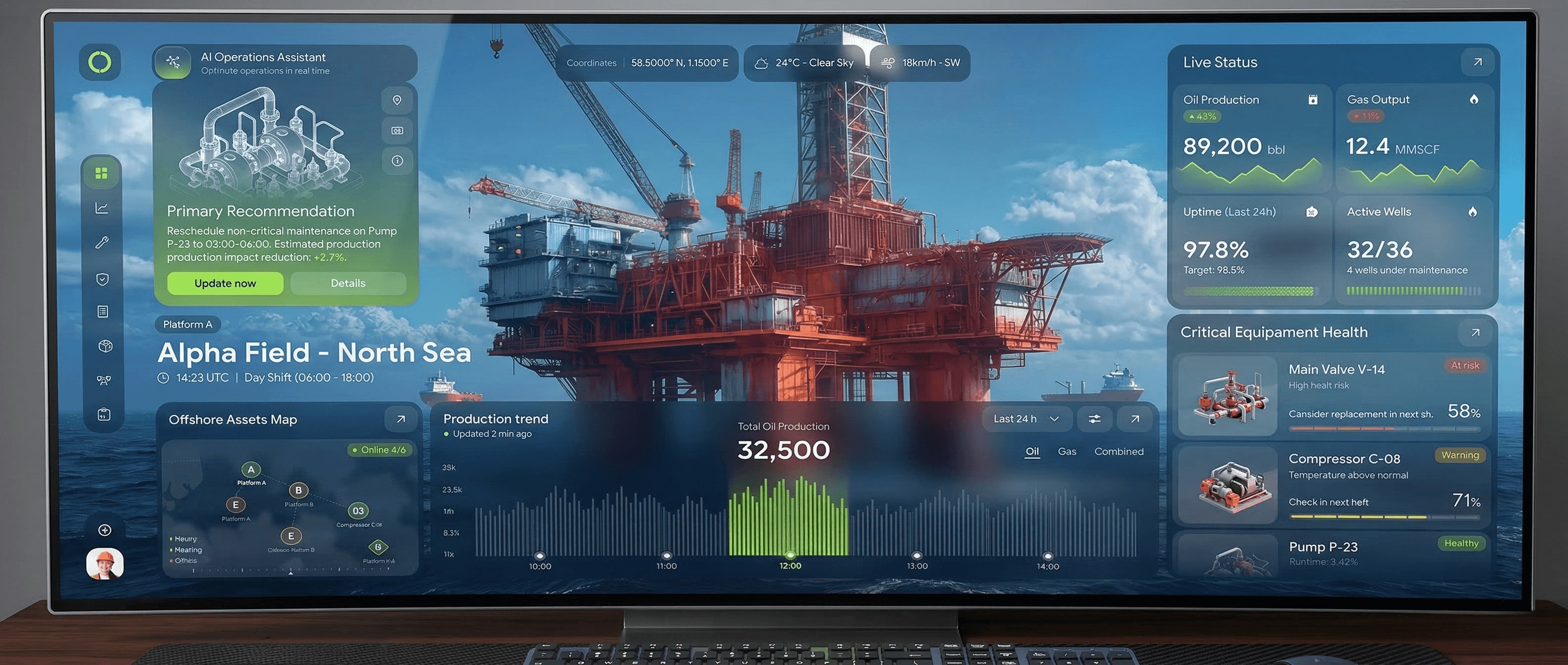
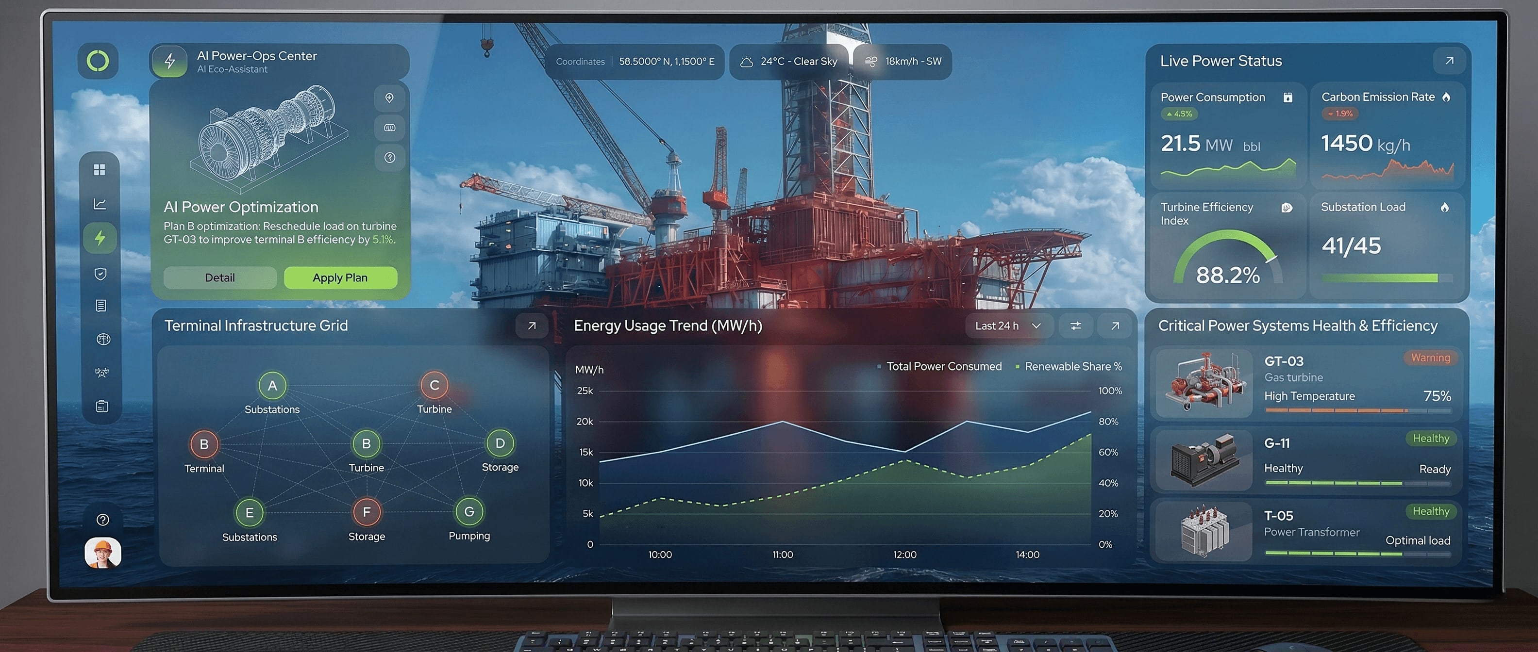
 DEVELOPMENT
 Surface Deformation & InSAR Validation
Surface Deformation Validator: Continuous validation of ground surface movement using high-precision satellite radar (InSAR) data.
Geospatial Risk Mapping: Identifying areas of subsidence or uplift to prevent infrastructure damage and ensure operational safety.
Temporal Analysis: Tracking deformation trends over time to differentiate between natural geological shifts and extraction-induced changes.
This module provides an "eye in the sky," allowing operators to monitor vast fields without the need for thousands of ground sensors.
DEVELOPMENT Reservoir Stress & Structural Integrity
Integrity Dashboard: Real-time visualization of the structural tension and physical integrity of the reservoir.
Physics-Informed AI: Combining traditional geophysics with machine learning to predict potential breaches or "Water Breakthrough" risks.
Mass Balance Control: Ensuring strict mathematical control over the reservoir's material balance to maximize production efficiency.
By predicting structural risks before they manifest, ARIS protects multi-billion dollar energy assets from environmental and operational disasters.
DEVELOPMENT Interwell Connectivity & Optimization
Hidden Channel Detection: Advanced analysis of hydrodynamic links between wells to find unintended leakage paths or "thief zones."
Injection & Pressure Scenarios: A simulator for calculating the ideal water or gas injection rates to maintain optimal reservoir pressure.
Field-Wide Optimization: Coordinating activity across hundreds of wells to ensure uniform depletion and extended field life.
The platform transforms raw pressure data into a clear strategic roadmap, significantly increasing the recovery factor of mature energy fields.